Some hiking trails are so easy they could be classified as boring. Other trails are so steep and challenging that only the fittest of hikers can enjoy them.
If you’re looking for a trail with plenty of cool things to see that’s not too easy or too hard, the trail to Lost Ranch in South Mountain Park is just right.
Hike summary:
- Length: 3 miles, out and back
- Difficulty: Mostly easy, with a couple of short, steep sections
- Precautions: Rugged shoes and 1 liter of water recommended
- Trailhead: 19th Ave & Chandler Blvd – Phoenix
- Pass/permit required: none
Note: 1 mile = 1.6 kilometers

After passing between two 30ish-feet-tall saguaros that serve as a gateway to the desert, you’ll wind your way through a pristine expanse of preserve. To the south are manicured backyards of a few dozen Ahwatukee Foothills homes. To the north sits a majestic mountain range that separates this vibrant bedroom community from Phoenix proper.

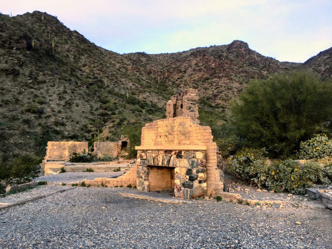
Set your sights on the “modern” ruins of Lost Ranch. They’re not old enough to be considered ancient. If you go all the way there and back, the total distance is only 3 miles from the trailhead, and you’ll only gain about 300 feet in elevation. Although fairly manageable for most people, there are a few steep sections that add some challenge to the experience.

What you’ll see:
- Lost Ranch ruins site
- Scenic desert landscape
- Towering mountain peaks
- Quail and other desert creatures
Watch: 3D overview of hike to Lost Ranch
Want to create cool videos of your outdoor activities with your phone? Try the Relive app.
Related: Many myths surround the history of Lost Ranch ruins in Phoenix South Mountain Park
Not too easy; not too hard: At three miles in length, the relatively short and moderately-pitched trail to Lost Ranch is just right. It only requires about an hour to hike to the ruins and back. You’ll enjoy great views along the way and score some pics of a unique site to share on social media.
Ready to check it out? Tap the map below to get there.
https://www.azcentral.com/story/travel/arizona/hiking/2016/12/29/david-yetman-trail-tucson-hike/95715610/
There’s a hike kind of like that in Tucson, southwest of downtown. A hike only about 1/2 hour in and you come to the ruins of an old house that was built (if I’m remembering correctly) by a man who worked on the Tucson newspaper a long time ago. I have no idea how he got in and out to work 🙂 It’s pretty lush out there with lots of cactus, a dry river bed and some hills.
I don’t know if my other comment was accepted. The stone house is called Bowen House, off of Camino de Oeste trail. You can get there the short way, off Speedway near Gates Pass, or the long way. I posted a link I found from the AZ republic but it isn’t showing up so may have ended up called spam.