
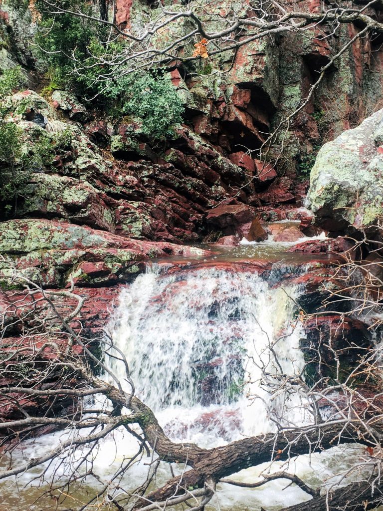
Many of Arizona’s most spectacular waterfall hikes require driving 3 to 4 hours from the city of Phoenix. Barnhardt Trail is less than an hour’s drive and will likely reward you with spectacular falls if you time your visit well.


What you need to know before you hike Banhardt Trail
- Level of difficulty: Moderate to Difficult
- Starting elevation: approximately 4,000 feet (1,200 m)
- Elevation gain: 1,930 feet (588 m)
- Total length of loop hike: 10.2 miles (16.4 km)
- Distance to falls: 2 to 3 miles, depending on recent moisture
- Best time to go: Winter or early spring after snow or rainfall
- Time required to hike: 3 hours or more
- Facilities: none
- Dogs: allowed if kept on leash
- Camping: limited dispersed sites (no facilities) available along access road
- Cost/pass: none required
Although the falls do not flow year round, this hike is beautiful any time of year.
Since it’s Arizona, expect extreme heat between the months of June and September. In the summer, hit the trail as close to sunrise as possible to beat the heat.
An abundance of deciduous trees and shrubs surely make for a spectacular show of fall color in November and December.


How to get to Barnhardt Trail
Less than an hour north of Phoenix on Highway 87, you’ll see a sign announcing Barnhardt Trail. The turnoff is about 17 miles south of Payson. After you exit the highway, head west four miles on the rugged dirt road to the trailhead parking area.
Caution: This road may not be passable due to mud for a few days after heavy rain or snow. High clearance is recommended since there are many deep ruts in the road.
Beautiful photos. I’ve not heard of this place. It looks wonderful!
Thanks, It was a new to me as well. Our timing couldn’t have been better. Rained over an inch the night before.