If you don’t have ‘Hike Keet Seel Canyon’ on your bucket list, I highly recommend that you add it right now.
The Keet Seel experience is so much more than a hike. It’s a 17-mile backpacking adventure over varied terrain, while dealing with high altitude, stream crossings and temperature extremes. The reward is a guided tour of one of the best-preserved ancient ruins sites in the Southwest.
Embrace the breathtaking beauty of Keet Seel, a place that will captivate your senses and leave an indelible mark on your soul. Journey into the heart of this enchanting destination, where ancient history and natural wonders converge in perfect harmony.


Feel the exhilaration of each step you take as you tread upon hallowed ground, tracing the footsteps of long-forgotten civilizations. Allow the ethereal aura of Keet Seel to transport you to a different time and place, where the past intertwines with the present, creating a tapestry of wonder and fascination.
How Keet Seel compares to other popular hikes in Arizona
I experienced Keet Seel in September 2019 and kept asking myself, “Why isn’t this hike as popular as Havasupai or the Grand Canyon?”
I’ve done all three and if I were to rank them on a scale from 1 to 10, with 10 being the highest possible score, I would rate them as follows:
- Havasupai: 10
- Grand Canyon: 9
- Keet Seel: 8
This simplified scale isn’t intended to imply that Havasupai and Grand Canyon are the only hiking experiences better than Keet Seel in Arizona. For sure other hikes, such as The Wave in Coyote Buttes, would score a solid 9; maybe a 10.
My point is that in the Grand Canyon State, you can’t find many hiking experiences better than Keet Seel. It offers plenty of adventure, amazing views, streams and waterfalls, plus ancient ruins. And it’s free! At the time of this posting, anyway; that could change.
Let the echoes of ancient civilizations resonate within you, as you uncover the fascinating stories etched on the walls of this unparalleled archaeological gem.
Ready to immerse yourself in the rich tapestry of Keet Seel as you explore its hidden secrets and marvel at its pristine landscapes? Use the two-day itinerary below to help plan your adventure.
Sample Keet Seel hiking adventure itinerary:
Day 1
- Attend mandatory 3 p.m. pre-hike orientation at Navajo National Monument Visitor Center
- Camp overnight in one of two campgrounds on the national monument grounds
Day 2
- Hike 8.5 miles from the trailhead to Keet Seel campground
- Drop your camping gear in a metal bin at the campground
- Proceed another third of a mile upstream for a ranger-led tour of ruins site
- Return to campground and set up camp, have a meal, relax, sleep
Day 3
- First thing in the morning, grab a quick bite, break down camp and begin hiking back to the starting point
- Feel the burn the last two miles as you climb back up rugged, rocky terrain loaded with switchbacks
Pictorial preview of the guide tour of Keet Seel ruins:


8 tips to help you experience Keet Seel Canyon like a boss
1. Make reservations in advance
Call Navajo National Monument Visitor Center at 928-672-2725 to reserve a permit. The actual permit is issued in person when you attend the pre-hike orientation.
Check guided tour availability
Keet Seel is only accessible to the public late May through early September, according to the schedule below.
- Thursday-Sunday: Overnight trips and day hikes are allowed.
- Monday: Day hikes are allowed. No overnight trips can be booked this day.
- Tuesday and Wednesday: Keet Seel is closed to all hikes.
A limited number of permits are issued each day and weekends are in greatest demand. To improve your chances of getting a permit, call a month or more in advance and allow the flexibility to hike on a weekday.
As of the time of this post (Sept 2019), there is no charge for the hiking permit, guided tour, campsite or park entrance.
2. Get oriented with the trail
In order to get your permit for this hike, you’re required to attend a pre-hike orientation the afternoon prior to your hike. You’ll get a slideshow preview of the hike with details to help you stay on the trail. The presenting ranger will help prepare you for the challenges you’ll face along the way.
Important: Be sure to get the one-page guide with details on how to navigate the 8-1/2 mile hike to the ruins. This guide is critical. Do not set out your hike with out it.

Note: The sign above is located about two miles from the start of the main trailhead for this hike.
Important: Navajo National Monument is not on Arizona time.
During the months when you can do this hike (May through September) Navajo Nation is one hour ahead of Phoenix and most other cities in Arizona. That’s because Arizona proper doesn’t participate in Daylight Savings Time but tribal territories do.
Bottom line: the 3 p.m. orientation is really 2 p.m. Phoenix time.
3. Begin hiking early in the morning
The trailhead for this hike is located at 7,300 feet elevation. In the first two miles, you descend over 1,000 feet in a winding maze of rocky switchbacks and steps formed with stone and railroad ties. A couple sections consist of deep, soft red wind-blown sand that gets hot quickly in the morning sun.
Since the 8.5-mile hike takes most people 4 to 5 hours, you’ll want to get an early start to avoid hiking during the hottest part of the day and allow yourself time to tour Keet Seel ruins.
After the initial descent, you’ll find yourself at the floor of the canyon, ready for your first stream crossing. There are at least a dozen more crossings before you reach the ruins.
The initial stream crossing is actually a confluence where several streams come together. This crossing is one of the trickiest because it’s the deepest and it feels like quicksand. The water’s only ankle to shin deep, but “waterproof” boots are no longer waterproof when the water is deeper than the top of your boot. Upstream from here you’ll be crossing the stream in ankle deep water many times.


4. Take good care of your feet
One of the best tips I can offer is to switch from hiking shoes to water shoes before the first stream crossing. That’s because your feet won’t be dry again until you reach this point on the return trip. So basically, your feet will be wet for about 12 miles of the 17-mile hike.
Pro tip: I discovered that wearing thin socks made of synthetic material with water shoes helps reduce chafing and blisters. For that reason, you’ll want to bring at least two pairs of socks. I had three – two pairs for water and one pair for dry terrain.
The dry section of this hike is short but also very steep. This is where you’re most likely to damage toenails or get blisters. I recommend high quality socks and shoes designed for rugged terrain on the dry portion of the hike.
5. Follow the white poles
Keet Seel is only one of the canyons in this region. Ending up in the wrong canyon could spell disaster. Thankfully, the National Parks Service has made it easier to find your way by installing tall white poles roughly every half mile. The poles also help you countdown how many miles left to the ruins site.

Along the way, you’ll cross the stream many times. You’ll also do some rock scrambling and face tricky obstacles here and there. Photo opps abound. Towering red rocks, wild horses and waterfalls are a few of the subjects to focus your camera on again and again.

6. Plan for no amenities after you start on the trail
This hike should be treated as a backcountry experience. With the exception of a vault toilet about a mile into the hike, there are no amenities along the way.
The Keet Seel campground consists of about a dozen sites dotted among oak trees and natural vegetation. There’s a sturdy picnic table for each site, plus two composting toilets for the entire campground. Hammock campers will be happy to know there are plenty of trees to tie up to.
7. Pack only what you need
Most people carry camping gear in their backpack and stay overnight in the primitive Keet Seel campground. This isn’t a terribly long hike, but you’ll need more than snacks and water if you’re going to stay the night. A lightweight tent and sleeping bag should provide adequate protection from the elements. Although the canyon floor really heats up during the day, I can attest that it gets quite chilly at night.
When I awoke on Day 2, I compared notes with another hiker. To help keep my pack light, I opted for a sleeping pad and left my sleeping bag in the car. She did the opposite. Although she kept warm, she declared it was her most uncomfortable night in a long time. I had a comfortable sleeping surface but had to put on all my layers to stay warm.
A husband and wife that I met in the campground slept in hammocks. They packed up and hit the trail at least an hour before first light. I’m not sure how comfortable they were, but my guess is they were pretty cold.
Sample packing list:
Gear
- Properly fitted backpack with waist belt and hydration bladder
- Two pairs of footwear – one for dry mountainous terrain; one for the stream
- Two to three layers of lightweight clothing; be able to cover your entire body
- Three pairs of socks – two for walking in water; one for dry sections
- Hiking poles really help distribute weight for water crossings and steep trail sections
Water and food
- One gallon per person per day – that’s two gallons for most people. Even people hiking out and back in one day should follow this guideline. (See my water tips below.)
- Lightweight snacks that require no cooking or other preparation
- High-sodium foods can help you retain water and stay hydrated
Other stuff
- Your favorite pain reliever, sunblock and small first aid kit
- Toothbrush and basic hygiene products (there is tissue and hand sanitizer in the bathroom)
- Change of clothes since you’ll do a lot of sweating and splashing in the stream
- A bag for your trash – you’ll need to pack out what you pack in
8. Carry and stash plenty of water
Rangers recommend at least a gallon per person per day. I can attest that’s a solid recommendation. Remember, the hike once you reach the canyon floor is about 12 miles, round trip.
On your way down to the canyon floor, look for a good place to stash a couple liters under a tree near the 6.5-mile post. That will lighten your load and ensure that you have water for the steep hike out of the canyon.
Although you’ll be walking in water for much of the hike, rangers advise against drinking water from the stream and falls, even if you filter it. Contamination sources include horse, cow and other wild animal feces, plus murky runoff from frequent rain showers.
I ran completely out of water before I began the return leg of the hike. Even though I stashed a gallon for my hike out of the canyon where the initial steep descent meets the canyon floor, I was facing a five mile stretch without water. Thankfully, I found the spring described below.
Insider’s tip: There is a natural spring source of water about a mile downstream from the Keet Seel campground

I filled up a few bottles from the spring in order to make it the next five miles to the water I stashed. I filtered the water through my Clearly Filtered water bottle and did not get sick.
Look for the spring on a portion of the stream that runs east-west, just past a large rock overhang on the right if you’re facing downstream.
Where to stay the night before and after your hike
For the night before and after the hike you can camp free at either Sunset View or Canyon View campground. Both campgrounds are well maintained and there is a picnic table and metal grill for cooking at each campsite. Neither offers electric or water hookups.
Sunset View campground is the larger and more modern of the two campgrounds at Navajo National Monument. The campsites are spaced out pretty well and offer easy access to multiple bathrooms with running water. If you stay in Sunset View you’ll need to drive to the Keet Seel trailhead and leave your car there overnight.
Canyon View campground is more primitive, with composting toilets and a few small trash receptacles as the only amenities. One plus is that most campsites are walking distance to the Keet Seel trailhead.
If you prefer modern lodging, there are hotels in the town of Kayenta 30 miles away.

The Keet Seel Canyon hike experience ranks up there with Havasupai and Grand Canyon. Get ready to be blown away by the breathtaking beauty of Keet Seel! This place is seriously magical and will leave you totally awestruck. Best of all, permits are relatively easy to get and there is no charge for the hike, camping or ruins tour. As with many great experiences, a little advance planning is required.
It’s time to let your inner explorer loose and immerse yourself in all the wonders that Keet Seel has to offer. Trust me, this is gonna be an adventure you’ll never forget. So what are you waiting for? Follow my tips above and you’ll be checking Keet Seel Canyon off your Arizona bucket list before you know it.
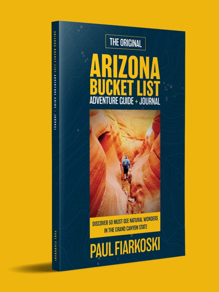
This simple book is changing the way people experience Arizona’s natural wonders.
Have questions? Post them in the comment box below and I’ll do my best to answer them.
Tap the map below for directions to Navajo National Monument Visitor Center.

About your guide
Since moving to Arizona in 2012, I’ve logged thousands of miles on hiking trails and byways. After a 3-day adventure to the falls of Havasupai in the Grand Canyon, I was inspired to author the bestselling Arizona Bucket List Adventure Guide & Journal that details the top 50 natural wonders in the state.
Looks like a beautiful but strenuous hike. I’m confused by the distance. You mentioned 8.5 miles one way, several times and that guide sheet states 6.5?
Great informative article, thanks. Loved the photos!
I noticed that too. I guess I better clarify it with a caption. That sign is two miles from the current Trailhead. Once upon a time you could park right near that sign.